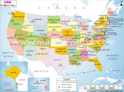
Parents: This week we are labeling all 50 states on a map. The students have a corresponding T-chart that list all states and their acronyms. We will be studying geography all year. I have asked the students to keep their map and chart in a safe place. If they keep up with it, they will be able to use them on test.
Students: Here are some questions you need to study for this weeks test.
What do all acronyms have to be? capital letters
What ocean is on the western side of the US? Pacific Ocean
What ocean is on the eastern side of the US? Atlantic Ocean
Boston, New York City, and Philadelphia are all in the ____________ region of the US. northeast
Is Mexico north or south of the US? south
Is Canada north or south of the US? north
Political maps show _______________. political units(the way land is divided)
Physical maps show _________________. the way the land looks
*Remember students* I will be asking you what region and what direction different places are . If you do not know how to use your map and t-chart, you need to talk with me. You have to use them for the test!
Never Eat Soggy Waffles:
You also need to know where Boston, New York City, and Philadelphia are located.
Political map of the US
Physical map of the US


No comments:
Post a Comment